
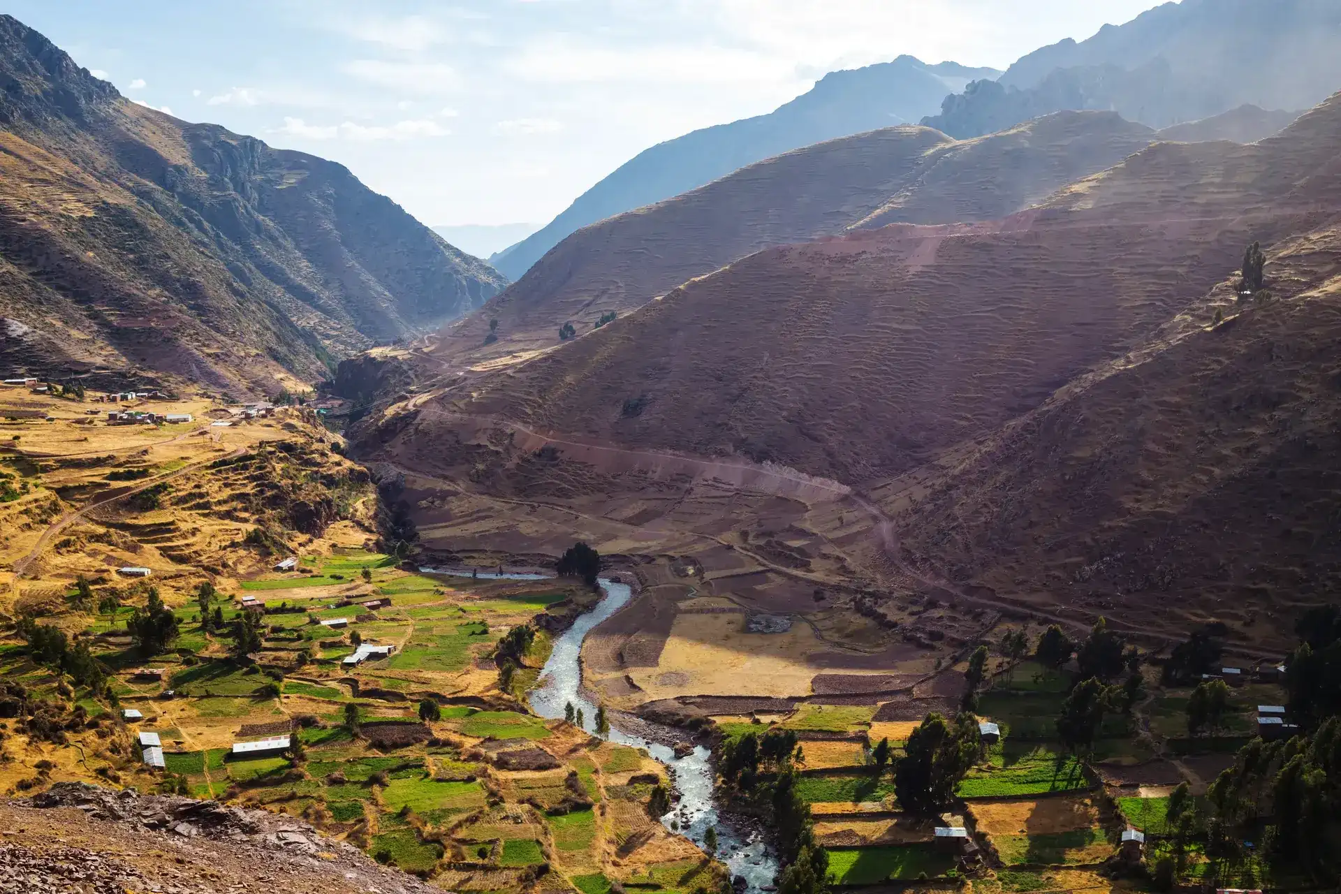
The Chinchero to Urquillos hike follows an old Inca road that descends from the Chinchero plateau to the floor of the Sacred Valley. It's almost all downhill, with views of the snow peaks of the Urubamba range, small waterfalls in season and villages where life still follows a farming rhythm. It's an excellent half-day hike to combine with a visit to Chinchero.
Start here: Cusco tips · things to do in Cusco
Where it starts
The trail begins below the large terraces of the Chinchero archaeological complex. From there, a sign marks the "Camino Inca Urquillos". Because the start is inside or next to the archaeological site, you normally need the Cusco Tourist Ticket, which includes Chinchero. Check access conditions at the entrance checkpoint.
- Chinchero: weaving, Inca ruins and market between Cusco and the Sacred Valley
- Cusco Tourist Ticket (Boleto Turístico): what's included and is it worth it
Popular activities on GetYourGuide
A road with history
Chinchero was a royal estate of the Inca Túpac Inca Yupanqui, and roads like this one connected the plateau with the maize fields on the valley floor. For centuries, farming families have used it to bring highland produce down and trade it in the valley. Walking it means following a route that is still in use, not a trail built for tourists.
Distance, descent and time
- Chinchero to Urquillos: about 8 kilometres.
- Descent: around 800 metres, from about 3,760 to about 2,980 metres.
- Time: 3 to 4 hours of walking, plus stops.
- Urquillos to Huayllabamba: about another hour on a flat track.
Figures are approximate and vary by source.
What the trail is like
The path is paved with stones in places and dirt and gravel in others. It zigzags down a ravine that gradually narrows; as you descend, the vegetation thickens and the temperature rises. During and shortly after the rainy season there are streams and small waterfalls. The main trail is easy to follow: at junctions, stay on the path that goes down.
A descent that's hard on the knees
Downhill doesn't mean easy. Some sections are very steep and loose gravel is slippery. Poles help a lot to protect your knees. Walk calmly and don't rush on loose ground.
Urquillos and Huayllabamba
Urquillos is a small village with a church on its square. From there a track follows the river to the edge of Huayllabamba, where you cross the bridge over the Vilcanota river to the valley's main road. There you can catch colectivos or a taxi to Urubamba, Calca or Cusco.
- Urubamba: the central base of the Sacred Valley (things to do, getting there and where to stay)
- Cusco to the Sacred Valley and Ollantaytambo: colectivo, taxi, tour and train
Getting back to Cusco
From the valley road there's frequent public transport to Urubamba and Calca, and from there to Cusco. Alternatively, arrange a taxi or private transfer. Plan your time so you don't travel back after dark.
- Getting around Cusco: taxis, ride apps, city buses and colectivos
- Private driver in Cusco and the Sacred Valley: when it's worth it and how to hire one
When to go
The dry season, from May to September, is the most comfortable. In the rainy season the trail gets muddy and small landslides can occur; on such a steep path, mud makes it dangerous. Start in the morning to avoid afternoon rain.
- Best time to visit Cusco and what to pack
- Rainy season in Cusco and Machu Picchu: what to expect and how to make the most of it
A good acclimatisation hike
Because you walk downhill, the cardiovascular effort is lower than on a climb. That makes it a good hike for your first days, even though Chinchero is at high altitude. Keep listening to your body and stay hydrated.
What to bring
- Enough water, at least 1.5 litres.
- Sunscreen, a hat and sunglasses.
- Shoes with a good sole; hiking boots are best.
- Poles for the descent.
- A warm layer for the start in Chinchero, which is cold in the morning.
- Cash for transport back.
Combine it with Chinchero
It's worth reaching Chinchero early to see the town, the colonial church and the terraces before you start down. If you visit on a Sunday, you can browse its market. The town's textile centres show the process of spinning, natural dyeing and weaving.
- Chinchero: weaving, Inca ruins and market between Cusco and the Sacred Valley
- Andean textiles in Cusco: weaving workshops, weaving communities and buying well
On your own or with an agency?
The trail is easy to follow and many travellers do it alone. Agencies offer it as a full-day trip with transport, sometimes combined with other valley sites. If you go on your own, share your plan with your lodging.
Respect
You pass through land belonging to farming communities. Don't leave rubbish, keep out of the crops and ask before photographing people.
Frequently asked questions
- How long is the Chinchero to Urquillos hike?
- 3 to 4 hours of walking to Urquillos, plus an hour if you continue to Huayllabamba.
- Do I need the tourist ticket?
- Usually yes, because the trail starts at the Chinchero archaeological complex; check conditions at the entrance.
- Is it difficult?
- It's almost all downhill, but has steep sections with loose gravel; poles help.
- How do I get back to Cusco?
- From Huayllabamba, by colectivo or taxi to Urubamba or Calca and then on to Cusco.
Book this plan
- Inca Trail to Machu PicchuCompareSee dates →
- Salkantay trekCompareSee dates →
- Inca Jungle trek to Machu PicchuCompareSee dates →
Notice: This guide shares advice and recommendations based on research and local experience. Prices, opening hours and rules may change: always check with official sources and operators. Cusco Tips is not responsible for third-party services, bookings or decisions made using these guides; some links are affiliate links (see our affiliate policy).
Related guides
Chinchero: weaving, Inca ruins and market between Cusco and the Sacred Valley
Chinchero guide: weaving centres and natural dyes, the Inca site and colonial church, the Sunday market, the Tourist Ticket, getting there from Cusco and how to combine it.
Read guide →
Cusco Tourist Ticket (Boleto Turístico): what's included and is it worth it
Guide to the Cusco Tourist Ticket (COSITUC): full and partial tickets, sites in each circuit, what it does NOT include, where to buy it and how to use it.
Read guide →
Pumamarca hike from Ollantaytambo: route, timings and tips
How to hike from Ollantaytambo to the Inca ruins of Pumamarca: route up the Patacancha valley, distance, elevation gain, walking down only, what to bring and tips.
Read guide →
Urubamba: the central base of the Sacred Valley (things to do, getting there and where to stay)
Urubamba guide: why it's the best base for exploring the Sacred Valley, things to do in town and nearby, getting there from Cusco and the airport, and what kind of lodging there is.
Read guide →