
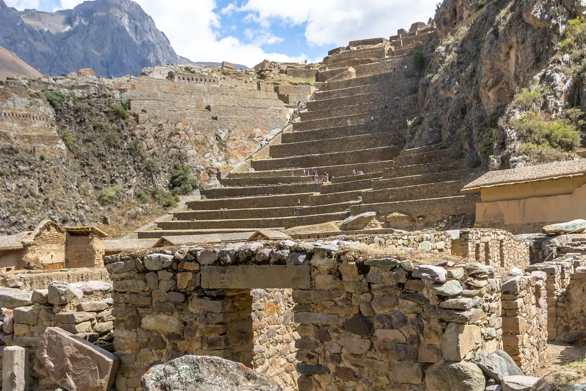
Pumamarca is a small Inca complex on a hillside above the Patacancha river valley, about 6 kilometres north of Ollantaytambo. Few tourists make it here, and that's exactly what makes it special: a trail through terraces, irrigation channels and farmhouses that ends at quiet ruins with views over two valleys. It's one of the best day hikes in the Sacred Valley for anyone who is already acclimatised.
Start here: Cusco tips · things to do in Cusco
What Pumamarca is
The site stands above the confluence of the Patacancha and Yuracmayo rivers. It's thought to have been a checkpoint controlling access to Ollantaytambo from the highlands. It still has walls, enclosures, storehouses and terraces, with the stone architecture typical of the Inca period. The name is usually translated as "town of the puma".
- Ollantaytambo: ruins, a living Inca town, the Machu Picchu train and tips
- Machu Picchu history: who built it, why, and how the world found out
Popular activities on GetYourGuide
The hiking route
From Ollantaytambo you leave along the street that follows the Patacancha river north. The path passes the small community of Munaypata and the Media Luna terraces, then zigzags up the slope. Higher up the trail eases off, crosses streams and follows old water channels until the ruins appear. The final stretch crosses farming terraces, where the path is less obvious.
Download the map
Carry an offline map with the route marked. Some junctions aren't signposted.
Distance, elevation and time
- Round trip from Ollantaytambo: about 12 to 13 kilometres.
- Elevation gain: a little over 500 metres.
- Time: 4 to 6 hours in total, depending on pace and stops.
- Difficulty: moderate, with steep sections at the start.
Figures vary by source and by the exact path you take, so treat them as a guide.
Downhill-only option
For a shorter version, take a taxi or hired vehicle to the community of Pallata, about 20 minutes from Ollantaytambo, walk the last stretch up to the ruins and hike back down to town. Many guided groups do it this way. Agree the transport price before you set off.
Entry
Different sources say entry has been free at some times and that a small fee has been charged on site at others. Carry some cash in soles just in case. Sometimes a caretaker is there to give information.
When to go
The best time is the dry season, from May to September. In the rainy season the trail can get muddy and the streams rise. Start early: mornings are cooler, the light is better and you have time before the afternoon clouds.
- Best time to visit Cusco and what to pack
- Rainy season in Cusco and Machu Picchu: what to expect and how to make the most of it
What to bring
- At least 1.5 to 2 litres of water per person; there are no shops on the way.
- Sunscreen, a hat and sunglasses.
- Hiking shoes with good grip.
- A warm layer and a light rain jacket.
- Food or snacks.
- Poles if your knees suffer on descents.
Acclimatisation
Ollantaytambo is at about 2,800 metres, lower than Cusco, which makes it a good place to acclimatise. Even so, the climb is demanding if you've just arrived. Do it after one or two days in the valley and keep a comfortable pace.
Respect for the communities
The trail crosses farmland and passes houses. Don't walk on crops, close any gates you open, ask before photographing people and take your rubbish with you. You may meet dogs on the way: stay calm and don't run.
How to combine it
Pumamarca fits well into a two or three-night stay in Ollantaytambo, along with the town's ruins and the Pinkuylluna storehouses. It's also a good warm-up hike before a longer trek or the trip to Machu Picchu, since the train leaves from Ollantaytambo.
- Where to stay in Ollantaytambo: areas, pros and when it makes sense
- Trains to Machu Picchu: stations, companies and which class to choose
Photography
The best views are from the top of the site, looking over the Patacancha valley and the surrounding mountains. Mid-morning light shows the walls well. On the way down, the terraces and irrigation channels make good farming-landscape photos, especially in the dry season when skies are clear.
With a guide or on your own?
With good navigation and a map, many travellers do it on their own. A local guide adds context about the site and community life, and sorts out the transport logistics. If you go alone, tell your lodging your plan.
Frequently asked questions
- How long does it take to hike to Pumamarca?
- About 2 to 3 hours up from Ollantaytambo, and 4 to 6 hours round trip.
- Is there an entry fee?
- It has been free at some times and a small fee has been charged at others; carry cash just in case.
- Can I just walk down?
- Yes, by driving to Pallata and hiking down to Ollantaytambo.
- Is it difficult?
- It's moderate, with steep sections at the start; you should be acclimatised.
Book this plan
- Inca Trail to Machu PicchuCompareSee dates →
- Salkantay trekCompareSee dates →
- Inca Jungle trek to Machu PicchuCompareSee dates →
Notice: This guide shares advice and recommendations based on research and local experience. Prices, opening hours and rules may change: always check with official sources and operators. Cusco Tips is not responsible for third-party services, bookings or decisions made using these guides; some links are affiliate links (see our affiliate policy).
Related guides
Ollantaytambo: ruins, a living Inca town, the Machu Picchu train and tips
Guide to Ollantaytambo in the Sacred Valley: what to see at the archaeological site, the town and Pinkuylluna, getting there from Cusco, the train station and whether to stay.
Read guide →
Where to stay in Ollantaytambo: areas, pros and when it makes sense
Guide to sleeping in Ollantaytambo: why it's the best base for the Machu Picchu train, areas of town, what kind of accommodation there is and practical tips.
Read guide →
Chinchero to Urquillos hike: the Inca road down to the Sacred Valley
How to hike from Chinchero to Urquillos on an Inca road: start point, distance, descent, tourist ticket, getting back from Huayllabamba, season and tips.
Read guide →
Huchuy Qosqo trek: the one-day hike from Cusco to the Sacred Valley
Huchuy Qosqo trek guide: what this Inca site is, the 1–2 day route from Cusco to Lamay, elevation, difficulty, entrance, going with an agency or independently, and what to pack.
Read guide →